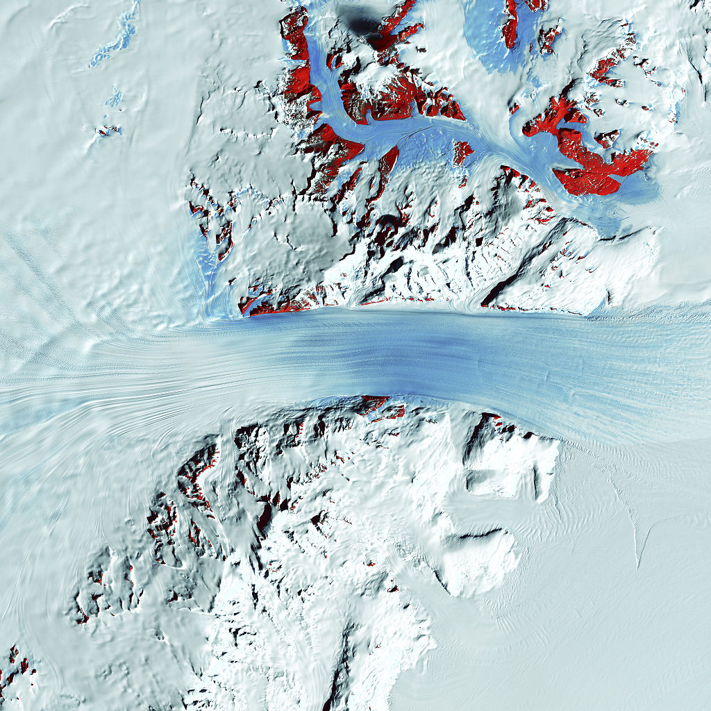
Truly a river of ice, Antarctica’s relatively fast-moving Byrd Glacier courses through the Transantarctic Mountains at a rate of 0.8 kilometers per year. More than 180 kilometers long, the glacier flows down from the polar plateau (left) to the Ross Ice Shelf (right). Long, sweeping flow lines are crossed in places by much shorter lines, which are deep cracks in the ice called crevasses. The red patches indicate areas of exposed rock.
Image taken January 11, 2000, by Landsat 7.
Credit: NASA/GSFC/USGS EROS Data Center
Download High Resolution JPEG (4800×4800 pixels; 6.4 MB)
Download the corresponding KML file for use in Google Earth