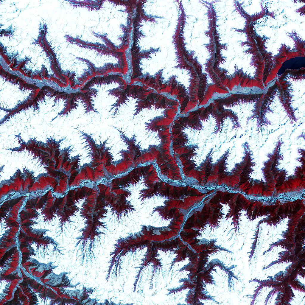
Soaring, snow-capped peaks and ridges of the eastern Himalaya Mountains create an irregular white-on-red patchwork between major rivers in southwestern China. The Himalayas are made up of three parallel mountain ranges that together extend more than 2,900 kilometers.
This image was acquired in February 2002 by the ASTER instrument on NASA’s Terra satellite.
This is a false-color composite image made using near-infrared, red, and green wavelengths.
Credit: NASA/GSFC/USGS EROS Data Center
Download High Resolution JPEG (4800×4800 pixels; 10.7 MB)
Download the corresponding KML file for use in Google Earth