
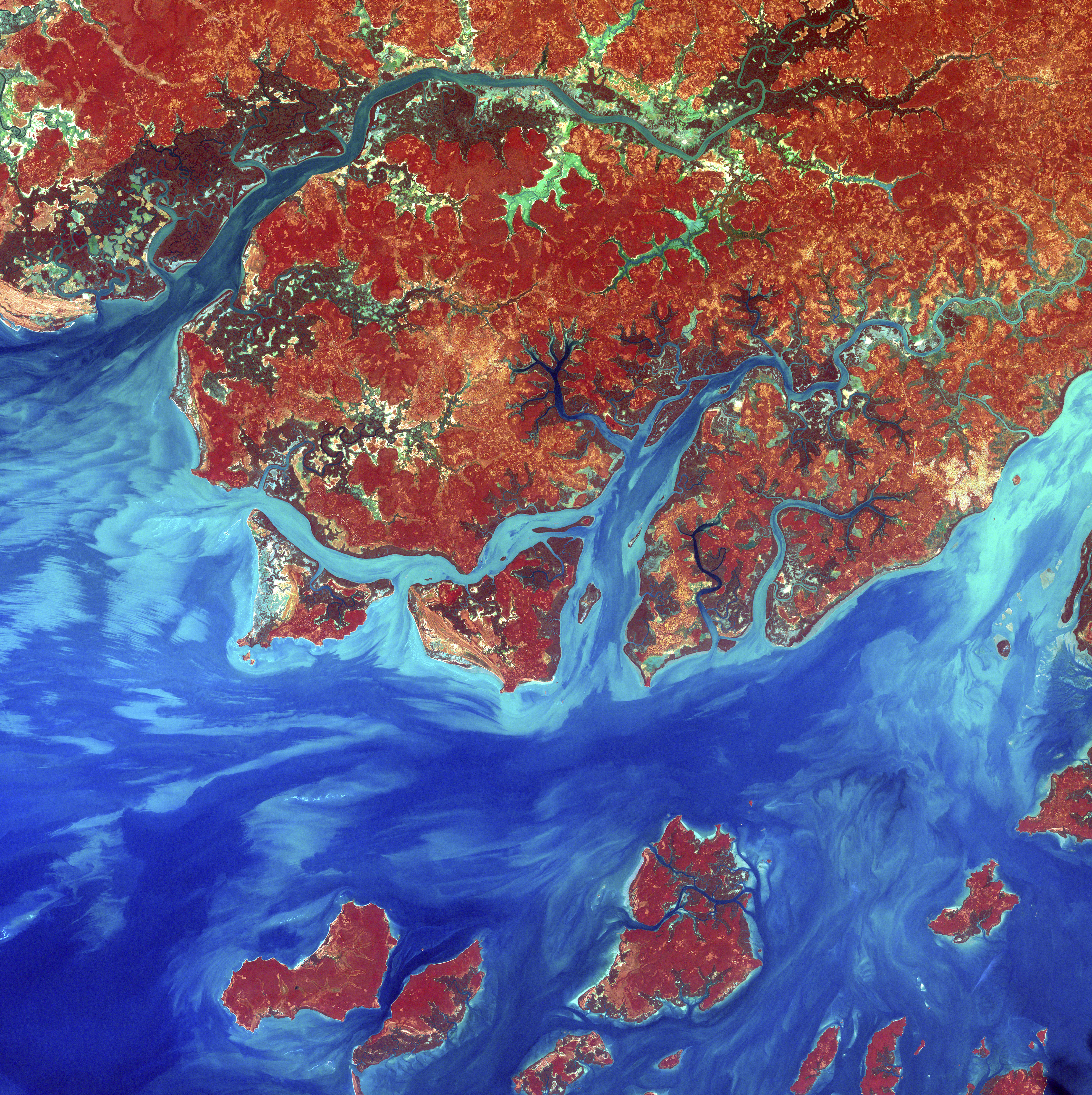
Guinea-Bissau is a small country in West Africa. Complex patterns can be seen in the shallow waters along its coastline, where silt carried by the Geba and other rivers washes out into the Atlantic Ocean.
This is a false-color composite image made using infrared, red and blue wavelengths to bring out details in the silt.
Image taken December 1st, 2000, by Landsat 7.
Credit: NASA/GSFC/USGS EROS Data Center
Download High Resolution JPEG (4785×4800 pixels; 10.5 MB)
Download the corresponding KML file for use in Google Earth